Bridges Carried Away

I 'd launched from the boat launch near the Bill Ashe Visitor Center in Devens and paddled upriver on a beautiful afternoon...

Along the way I encountered this spike deer...

...and a ghoulish-looking remnant of a hornet nest...

The stonework was encountered just before reaching the Jackson Road Bridge and is located in Lancaster just over the line from Shirley, on the river's west shore. The bank here is on the outside of a sweep in the river where it would have eroded if not for the stones...

Approaching still closer showed the gaps between stones are providing a riverside-home to this "fishing spider?"...

On my return trip downriver I promised myself to investigate the location and, upon doing so, found some possible explanations. In the book History of the Town of Harvard 1732 - 1893 by Henry Stedman Nourse the author notes a 1794 map showing three bridges spanning the Nashua in Harvard. He lists them in order from upstream to downstream as : Captain John White's Bridge built in 1735 in Still River; Wilds's Bridge (aka Shaker Bridge) named for Elijah Wilds, a Shirley Shaker; and the Shabikin Bridge (near the present day Bill Ashe Visitor Center). Of these three, only Wilds's Bridge (Shaker Bridge) seems a good fit for the location of the hand-laid stonework. Nourse (writing in the late 1800s) states: "This bridge was carried away by a freshet early in this century, and was for several years replaced by a temporary floating bridge during the summer. Portions of old abutments are yet visible." The bridge was said to be 116 feet long with stone abutments and 2 trestles. The bridge was built and maintained by the Shakers living on the river's west side. Having the bridge allowed them to cross the river in order to visit the Harvard Shaker Village as well as gain access to their hay fields. A map included in Nourse's book shows the location and what appears to be an abandoned roadway (dotted lines) leading to the river...

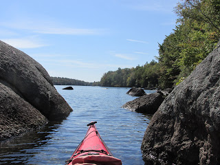
So this past Monday, armed with this info, I launched upstream at the Oxbow (just below Captain John White's Bridge) in Still River and paddled downriver about 2 miles to where the abutment came into view...


If so, I tip my hat to their good work.
The shore opposite the abutment?...

A few flat rocks were seen on the river bottom on this side and it looks as though the Shaker's route may have followed the river's north and east shore towards present day Jackson Road (in distant right of above photo).
Today this is a slough but topo maps show it once having been the original course of the river.
Map from 1939...

Map from 1951 showing the change in river course resulting from Jackson Road Bridge...

I paddled along the original but now cut-off channel from the suspected Shaker bridge for about 600 feet to a good spot for landing where a dry swale meets the river. Walking back towards the Shaker Bridge I came across these old timbers laying on the ground...

After poking around a bit I headed back upriver and caused a bit of a ruckus while in the vicinity of this active osprey nest...


Once past the nest I began looking for a fourth bridge mentioned by Nourse's History of the Town of Harvard..."A fourth bridge, that of the Union Turnpike Company, between 1805 and 1818 spanned the stream about halfway between White's and Wilds's. This was twice ruined by freshets, and the traffic over the turnpike did not warrant the expense of rebuilding." That combined with the fact it was laid out "in an almost straight line, paying no attention to grades" resulted in it losing considerable traffic to another turnpike with easier grades.
This map from History of the Town of Lancaster shows the turnpike's route approaching the river from the west...

In wanting to confirm the bridge's location I went ashore on the Harvard side and followed the Riverside Trail to where it meets the Turnpike Trail.
Map from Oxbow National Wildlife Refuge Recreation and Trail Guide...

Photo of trail marker nearest the bridge abutment...

The view eastward from the river...

I try to imagine the Union Turnpike when it enjoyed a brief heyday after being built, and was described as follows in History of the Town of Harvard by Nourse "The roadway was laid out in December, 1805, and furnished one link in a direct thoroughfare between Albany, Greenfield, Brattleborough, and Boston, joining the Cambridge and Concord pike with the Fifth Massachusetts Turnpike at Leominster. The traffic over the latter was then very great, carried on by a procession of heavily laden wagons bearing freights of country produce to the city markets and returning with assorted merchandise for the village stores. From forty to fifty such wagons daily traversed the main road, averaging a freight of at least a ton each." Once on the river's east side those wagons would begin a slow and steady climb up Makamachekamuck's Hill (aka Prospect Hill).
I wasn't able to find any trace of the bridge or its abutments within the river. The air, however, was filled with birdsong on a fine June day, only occasionally interrupted by bursts of machine-gun fire from the Fort Devens training center just across the river.


Comments
Post a Comment