Posts

Showing posts from December, 2018

Stick a Paddle in It...

Image
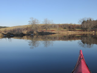
...because 2018 is nearly done and preparing to leave in fine fashion compared to its predecessor. Unlike last year when the paddling season ended abruptly, I had the luxury of knowing this past Saturday would be my last paddle of the year and thereby was able to savor it as such...and also savor the unseasonable warmth. So, while paddling the Concord River between Bedford and Billerica I reflected upon the past year which included: Exploring new sections of the Housatonic in CT, the Hoosic in NY, the Ashuelot, Cochecho, and Souhegan in NH, the Kennebec, Cobbasseecontee, Sebasticook, and Wesserunsett in ME. Paddling to the Native American villages of Nanrantsouak in ME and Menamesit in MA. Paddling to historic Native American fish weirs in the Ashuelot River, Sebasticook Lake, and the Assabet River. Paddling and camping along a stretch of the Connecticut River's Upper Valley in October with fellow paddlers Bill, Conrad, Erik, and Jonathan. However, one 2018 experien

Suneanassit and the Empty Canoe

Image
After emerging from beneath one old mill building and seeing the towering smokestack of another... ...I recognized the location as the place where I'd experienced the fun of a few dental root canals.  Fortunately for me, this past Thursday afternoon pain relief wasn't on my agenda. In fact I hadn't really planned on ascending Stony Brook or "Suneanassit" as it was known by the Native Americans.  Today's maps show it as North Chelmsford, MA.  My only intention was to duck into the brook from the Merrimack River for a quick peek...and oh well, next thing I knew I'd paddled 3/4 of a mile upstream... The day was a beauty with sunshine, temperatures on the plus side of 40 degrees, and light winds from the southwest. The trip back down the brook to the river provided a canal feel and look... ...bringing me back to the beneath-the-building portion... ...where the light at the end of the tunnel looked too small at first... ...then thankfully

Not So Nippy

Image
Despite the prevalence of these bite-sized bottles, yesterday was actually on the warm side for a change...55 degrees recorded in Concord, MA.  Our relatively dry stretch of weather over the past 2 weeks resulted in some of the actual text of the Egg Rock inscription being legible ... ...rather than completely submerged as it was as recently as December 3rd... The drop in level meant no easy passage over some of this tangle on the Assabet River between Spencer Brook and Route 2... The Sudbury, on the other hand, was obstacle-free... ...though the earlier bits of sunshine became more obscured. Some bridge repairs were underway at Elm Street... A benign-looking Nashawtuc Road bridge welcomed this paddler... Amazing just how good 55 degrees outdoors can feel.

Winter at the Door

Image
I preferred not to answer that door this past Tuesday and instead spent a few pleasant hours out on the Assabet River earlier this week during what comprised the "heat of the day"...temperatures on the plus side of freezing and a soft spoken wind. Both the river and sky were blue while between them was a mostly brown and barren-looking landscape.  Any bits of color stood out starkly such as this once festive balloon... It was 10 days before the official start of winter and 100 days before the official start of spring.  While I prefer to focus on the latter I can't help but wonder what the former holds in store. When I stopped to stretch my legs at a wooded section on the river's west side I came across this solar farm... ...which was busy gathering-in the day's sunlight.  Just a short distance from this high-tech equipment was this low-tech stonework from long ago... Further downriver this musquash took advantage of a thin platform of ice to incre

Bridge of Flotsam

Image
It stretched all the way across the Nashua River in Lancaster, MA and looked to have entrapped a substantial amount of flotsam. I believe it's the first time I've ever seen a trash trap this entrenched running bank to bank.  A closer look better shows its eclectic composition... ...including a wide variety of plastic containers which, by the way, I'm fairly certain originated on this continent. The bridge of flotsam was encountered yesterday about 3.7 miles upstream from the Oxbow Boat Launch in Harvard, MA.  I'd paddled upriver in an attempt to reach a previous downriver turnaround spot. My gps showed the desired spot being another quarter mile beyond this obstacle.  It was only with the help of high water levels that I'd been able to make it this far upriver.  All of my previous attempts fell short. The line from "Jaws" came to mind... "You're gonna need a bigger boat".  Dealing with this much trash would require many hands and a t

Paddling to Neck Bridge

Image
I'd seen the above sign when driving home from a recent paddle on the Nashua River's North and South branches in Lancaster, MA.  The sign looks almost as forgotten as the bridge and ancient route it commemorates and stands sentinel at a bend in Neck Road overlooking a wide and desolate-looking floodplain.  Seeing mention of a bridge and its having once been a "main thoroughfare" more than piqued my curiosity and some searching on the internet provided the following information:  According to Joseph Willard in his 1826 Topographical and Historical Sketches of the Town of Lancaster Massachusetts the road to Concord was laid out in 1656 and crossed at the wading place of the Penecook (today's Nashua River) to the east of what was afterwards called the Neck Bridge.  It continued to be a fording place until the Neck Bridge was built in 1718.  Another historian, Rev. Abijah P. Marvin in The History of Lancaster Massachusetts: from the first settlement to the present