Posts

Showing posts from May, 2018

Weirs Play Hide-and-Seek

Image
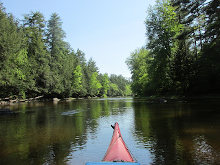
On a beautiful spring morning last week I'd paddled against a New England river's gentle current until all sounds of civilization were absent.  Here I found a most peaceful and quiet spot with the only sounds being the occasional rustling of treetops from a gentle breeze and the slightest gurgling sound of water passing over the exposed stones...this was my destination and a special place... After landing my kayak, I waded out to the middle of the river where the apex of an ancient V-shaped fish weir is clearly visible.  Standing there allowed me to occupy the same space where once, long ago, a Native American likely stood with his spear at the ready.  Standing mid-calf deep and letting the river's cool waters surround my feet, I tried to imagine this weir and the adjacent riverbank eons ago when migrating fish and eels were harvested here.  This was the perfect spot for wiling away the middle of the day.      Eventually, I did continue my passage on the river and enc

A Confluential Place

Image
As one who's very fond of exploring river confluences I recently spent two days paddling the waters of Maine's Merrymeeting Bay.  As the above map shows Merrymeeting provides a plethora of confluences and, conveniently, they're all concentrated in a basin measuring roughly 7 miles long by 3 miles wide. In addition to two tide cycles each day, the bay receives waters from 6 tributaries.  Of these the most senior is the Kennebec River (whose waters emanate from Moosehead Lake) entering at the map's top right (above Swan Island).  A close second is the Androscoggin River (whose waters emanate from New Hampshire's Umbagog Lake) and enter at the map's bottom left by Mustard Island.  Add four smaller rivers into the mix: Abagadasset, Cathance, Eastern, and Muddy, let them all mingle a bit until the ebb tide allows their exit through the narrow outlet known as "Chops" and onward the remaining 17 miles to the Gulf of Maine. Samuel de Champlain, one of the