Posts

Showing posts from January, 2019

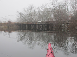
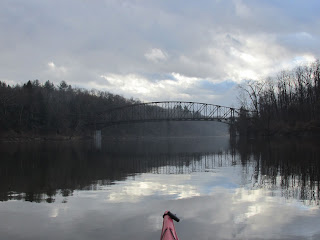
Blessings on the Assabet

Image
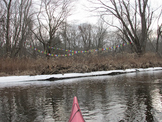
These colorful flags caught my eye when paddling the Assabet River the other day...how could they not have against such a muted background?  Suspected they were Tibetan prayer flags and later confirmed that to be the case when I found the following info on the internet (mostly Wikipedia): The prayer flags bless the surrounding countryside and are displayed in sets of five colors.  Each color represents one of the five elements: blue for space, white for air, red for fire, green for water, and yellow for earth.  Those seen represent the Lung ta or "windhorse" style and are made of cloth with wood-block printed text and images.   Older flags are usually replaced with new flags at the time of the Tibetan New Year (which this year occurs on February 5th).  By the way the flags were arranged it appears the person who placed them was looking toward the river.  I must have instinctively known the prayers (for peace, compassion, strength, & wisdom) are meant to be carried o

While It's Still Open

Image
Couldn't pass up one more chance to enjoy our rare (for January) ice-free conditions this past Tuesday when cool, calm, and foggy conditions were the order of the day.  The Sudbury River in Wayland passes under Central Mass Railroad trestle (above), Route 20, and high tension power lines all in quick succession. A slight lowering of the river level left what look like ice flowers in some places... A musquash used what little ice there was as his platform... Near Heard Pond this bald eagle also took advantage of the still open water... ...before taking flight... This was the 7th mature eagle I've encountered while paddling since mid-December. Mute swans also enjoyed the peaceful setting... Approached the Pelham Island Bridge as a drizzle/mist developed and my trip neared its end... ....another half mile to my takeout and a warming cup of hot cocoa.

Paddlin' to the Arches

Image
This past Friday proved ideal for visiting a different kind of water route...especially considering that it's January in New England...45 degrees F with no ice to contend with. Leaving the Charles River and ascending Waban Brook I approached the "Waban Arches" finding it hard to imagine that water from the Sudbury River once flowed high above within its red-bricked portion...yet, as recently as 1978 as much as 90 million gallons per day did just that.   The view from the Charles just a bit downriver from where it looks as though the river itself passes through... The 1876 date serves to remind it was built and placed into service by the Boston Water Works at the time of our country's centennial... ...and coincidentally the same year a hot and dusty battle occurred out west in Montana where General George Armstrong Custer possibly swigged his last sip of water from a canteen...or possibly a flask, before his ride into infamy. According to the Massachuset

Convergence Points on the Connecticut

Image
New Years Day 2019 and I'd just launched from Pauchaug Brook Access in Northfield, MA.  Skies were fickle, temperatures above normal, and gusty winds from the W/NW predicted.  Before turning about and heading up the Connecticut River's west shore, I looked to the south and the Schell Bridge.  It was from that direction that 2 canoes were being hurriedly paddled upriver in the pre-dawn hours way back in July 1698.  The four Native American men paddling had conducted a late-day raid on some English farmers more than 20 miles downriver in Hatfield North Meadow.  They'd killed 2 men and taken 2 boys, 11 year old Samuel Dickinson and a lad known only as Charley, captive during the raid.  The captives were spirited to canoes hidden by the river and the long journey to possibly Canada began.  Perhaps holding them for ransom was their motive but we'll never know for sure.  In darkness they'd made what must have been a difficult portage of the great falls at Peskeompskut b