Convergence Points on the Connecticut

Since I'd be hugging the river's west shore, and in honor of it being New Years Day, I stopped at the riverbank spot where 3 states converge; Massachusetts, New Hampshire, and Vermont...

Found the gps coordinates for the above boundary marker on the waymarking.com web site. Another even larger monument known as the Mud Turtle once served as the marker but has been submerged beneath the water for many years.
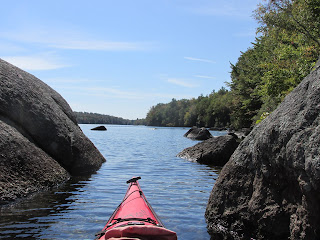
After passing the old abandoned railroad bridge abutments...


It's an island that was once said to be 12 acres in size but over time has been whittled away to only a fraction of that. I paddled along the island's eastern shore noticing this dead bald eagle...

The 4 Native American paddlers must have been exhausted as they reached this same spot having covered more than 25 miles through the night. Hiding on the river's west shore were the 14 Englishmen who'd reached a spot upstream of the island. The events which subsequently unfolded determined the name the island would bear for many years to come.
Historians Josiah H. Temple and George Sheldon told the story in their 1875 A History of the town of Northfield, Massachusett, for 150 years...: "In the early dawn they (rescue party) discovered two canoes in the distance, rapidly ascending along the eastern bank. Selecting a position on some broken land close to the water, they waited till the canoes appeared above the island, and opposite where they stood, when taking careful aim, they fired, one of the Indians was mortally wounded; but with the other three and one of the lads leaped into the stream and made for the shore. One lad remained in the canoe, and the other quickly turned to rejoin him. An Indian, noticing the movement, attempted to shoot him: but his gun missed fire, and he rushed upon the boy with uplifted hatchet. In this act he exposed himself so that he received a mortal shot from the party on the west bank. The boys, both unhurt, quickly paddled across to their deliverers."
The story should have stopped there with the rescuers having achieved their objective...but, unfortunately, it didn't.
With the rescue party now having one of the canoes in their possession and seeing the other canoe beached at the island's northern tip, someone decided that getting the beached canoe would allow them to pursue the remaining 2 Indians. So 5 or 6 men got into the canoe and paddled over to the island where they were caught by surprise when one of the surviving Indians stood amidst the tall grass and shot one of their party, a young man named Nathaniel Pomeroy of Deerfield. "They made his lonely grave on the west bank of the river; but his memorial is the island where he fell - which is called Pomeroy's island unto this day."
Brings to my mind numerous old sayings such as "don't press your luck", "quit while your ahead", "leave well enough alone", etc, etc.
I landed at the island's northern tip...

All but the highest parts of the island were coated with a recent deposit of Connecticut River mud which is as slippery a mud as I've seen. Where someone built a work table of sorts, perhaps to support camping, a heavy layer of muck coats the ground...

...while just a ways from there was this area ideal for the pitching of tents...

Pomeroy's island is located about a quarter mile down river from the mouth of the Ashuelot River.
The trip back down to Pauchaug included this sky of contrasts...


When driving away from the boat access I noticed another monument almost immediately across the road and wondered if this unfortunate man was related to the 11 year old captive Samuel Dickinson...


Comments
Post a Comment