Connections on the Saco

This was my first camping trip of the 2019 season and my tent had been pitched within a 2-mile radius of the confluence. Somewhere within the same 2-mile radius was, more than likely, the trading post of Englishman Francis Small. The 43 year old Small is said to have been the first European to venture into this area in 1668, and he began trading with the Sokokis band of Wabanakis people by allowing them to obtain his wares on credit...with the expectation they would pay their debt with pelts, etc in the fall. There apparently was a misunderstanding, and the debtors decided to eliminate their obligation by eliminating Mr. Small. Sokokis sachem Wesumbe (aka Capt. Sandy) alerted Small to the debtor's plan and on the appointed night Small watched from the woods as the debtors set fire to his trading post. Mr. Small then took it on the giddy-up down to relative safety in Kittery. Wesumbe later followed him there and, in an effort to make things right, agreed to sell Small a huge tract (20 square miles) of Sokokis land. The deed bore Wesumbe's mark of the turtle clan. Due to many decades of Native/Colonist sporadic warfare Small was never able to return to his tract of land and eventually spent his last years in Truro, Massachusetts. However, about one hundred years after the transaction, his descendants found the deed and had it recorded in 1773. In the ensuing years descendants of William Phillips claimed he had purchased the same land from Wesumbe and they contested the Small deed. In reading about the legal dispute I encountered the concept of "livery and seisin by turf and twig" an odd ceremony brought over from medieval England. I can only imagine what the Native Americans thought when witnessing such a ceremony. Check out this video recreation.
Anyhow, I paddled up a Saco River swollen with snow-melt towards the confluence passing along the way this riverside shack...

The last sign of civilization I saw before reaching the confluence was the USGS gauge station...

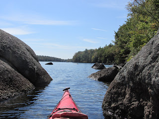
At the confluence I veered left into the Ossipee River...


... and, after going ashore, looked up to the plateau above...

Before returning back downriver I paddled another tenth of a mile up the Saco where this eagle's nest caught my eye...


In addition to experiencing the Saco/Ossipee confluence I planned to paddle other stretches of the Saco but encountered locked gates (perhaps due to high water levels) at many of the access points. My plans were modified on the fly.
This photo at Hiram Dam attests to the power of the Saco...

One launch site that was open was Lovewell Pond (aka Saco Pond) in Fryeburg which afforded this view of a snow-covered Mount Washington to the northwest...

Lovewell Pond is said to have been a well used canoe route for Native Americans in providing a shortcut and thus avoiding the Saco's 32-mile meander to the north (Old Course Saco). From the large Pequawket village near where the Fryeburg fairgrounds are presently located Native American canoeists could make an approximately 2-mile portage to Lovewell's north end, then paddle 2.5 miles down to the pond's south end where its outlet would lead them to the Saco again...

Today's paddlers are lucky to have a sign to help them locate the pond's outlet. The short paddle to the Saco is down this tree-lined channel...

Once in the Saco I paddled upstream for about 1.5 miles enjoying the company of these small yellow birds...


I turned about at this handsome stand of trees...

Once back at Lovewell Pond I found a northwest wind had risen and decided against paddling to the ponds north end. Instead I drove there and found the monument to the pond's namesake near the intersection of Lovewell Pond Rd and Battleground Rd...


On another day I paddled a different Saco River tributary body of water and experienced the highlight of my trip. In doing my pre-trip research I came across mention of Native American pictographs at this particular water-body and therefore kept an eye out for them while paddling. Eventually I saw a cliff that looked like a possibility. A scan with binoculars didn't look promising, but I found a way to approach just a little closer and saw through my binoculars something that looked like the form of a man holding a bow...

Other images were also painted on the rock...

Once at the cliff's base I found myself standing on the same footholds the original artist must have used while creating his paintings...

Experts have dated the pictographs to between 1,000 to 3,000 years before present time. Some of those same experts believe a shaman used red ochre to paint the figures while trying to connect with spirits believed to inhabit such powerful locations. The cliff faces eastward and would receive the day's first rays of sunlight.
I paddled into a nearby brook to where stone formations seemed to provide a natural sanctuary...

Upon returning to the pictograph site a loon surfaced...


Comments
Post a Comment